03 Apr 2010, Vero to Carolina Beach, non stop, 31 06.15 N/ 079 03.396 W
|
|
|
|
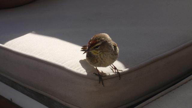 At 0730 day before yesterday, we
broke from Sirius Endeavor and headed south(?) heading for the Cape
Fear. We headed for the closest inlet, which was Fort Pierce. Sadly,
the current was against us and it took a long while to pass through the
inlet. Within four hours, we were feeling the effects of the Stream and
northbound we were headed with speeds up to 10 kts. Yep, we were motor
sailing again 'cause we had a rather tight weather window. Along the
way a little bird, named Chirpy, boarded Jule. We were about 100 miles
offshore and we were concerned the Chirpy would either get eaten by
Sammy or die of exposure. We took a chance and opened up the cabin.
Chirpy hopped on Sammy but Sammy did not strike back. Adventure on the
high seas. (We did not find Chirpy so we assume he flew away during the
night) At 0730 day before yesterday, we
broke from Sirius Endeavor and headed south(?) heading for the Cape
Fear. We headed for the closest inlet, which was Fort Pierce. Sadly,
the current was against us and it took a long while to pass through the
inlet. Within four hours, we were feeling the effects of the Stream and
northbound we were headed with speeds up to 10 kts. Yep, we were motor
sailing again 'cause we had a rather tight weather window. Along the
way a little bird, named Chirpy, boarded Jule. We were about 100 miles
offshore and we were concerned the Chirpy would either get eaten by
Sammy or die of exposure. We took a chance and opened up the cabin.
Chirpy hopped on Sammy but Sammy did not strike back. Adventure on the
high seas. (We did not find Chirpy so we assume he flew away during the
night)
|
|
|
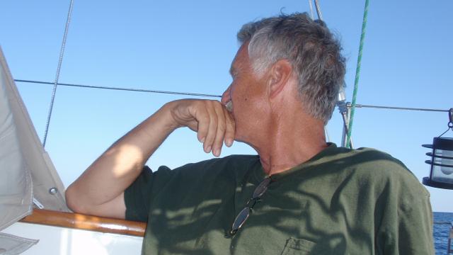 Lots to think about while making the passage. The
weather was generally good but the wind was light and heading for the
stern. Seas were rolly but manageable. Poor motor has been used most of
this trip. This leg will not be different as the forecast has winds 10
kts or less aft of the beam. Still it is a remarkable (motor)sail. Lots to think about while making the passage. The
weather was generally good but the wind was light and heading for the
stern. Seas were rolly but manageable. Poor motor has been used most of
this trip. This leg will not be different as the forecast has winds 10
kts or less aft of the beam. Still it is a remarkable (motor)sail.
|
|
|
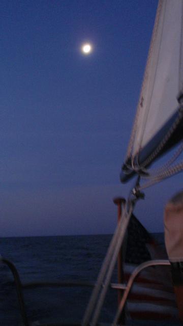 The night receives the moon around
2345 and it is a bright one. Truly a beautiful night with fair (albeit
light) winds and calm seas. Yesterday, the water was a deep blue, sky
was blue with just the hint of low level clouds; and a swell from the
NE. What is causing that? The swell was mesmerizing but the clouds
continued to deepen. The swells reached 7-8 feet and the period became
shorter. The 'toy' was showing winds out of the NE. Within a half
hour, the wind picked up; out of the NE. Seas continued to steepen. We
headed NW to leave the Stream and get back to the easterlies. Within 4
hours we were settled again but largely out of the Stream. The night receives the moon around
2345 and it is a bright one. Truly a beautiful night with fair (albeit
light) winds and calm seas. Yesterday, the water was a deep blue, sky
was blue with just the hint of low level clouds; and a swell from the
NE. What is causing that? The swell was mesmerizing but the clouds
continued to deepen. The swells reached 7-8 feet and the period became
shorter. The 'toy' was showing winds out of the NE. Within a half
hour, the wind picked up; out of the NE. Seas continued to steepen. We
headed NW to leave the Stream and get back to the easterlies. Within 4
hours we were settled again but largely out of the Stream.
|
|
|
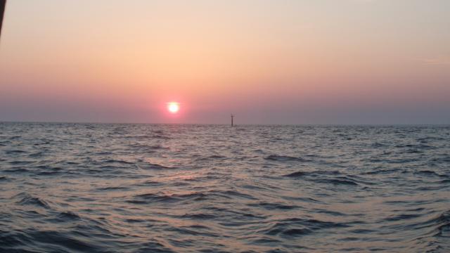 We re-caclulated our ETA to
the Cape Fear inlet and were not happy that our first estimate of a
night landfall was not far off. Surely, we would drive most of the way
to Carolina Beach in the dark. The night was calm and the seas had laid
down to 2-3 ft. We have not seen any boat traffic on the radar or AIS
for nearly 24 hours. Kinda lonely here. We re-caclulated our ETA to
the Cape Fear inlet and were not happy that our first estimate of a
night landfall was not far off. Surely, we would drive most of the way
to Carolina Beach in the dark. The night was calm and the seas had laid
down to 2-3 ft. We have not seen any boat traffic on the radar or AIS
for nearly 24 hours. Kinda lonely here.
|
|
|
Page 1
Page 2
Page 3
Page 4
Page 5
Page 6
Page 7
|
 ;
;


