23 Sep 2016, Outrunning TS Julia -Elizabeth City, 36 17.982 N/ 076 12.696 W
|
|
|
|
 Another tropical system moving our way. We estimate that
we have to find our next hidey hole by 19 Sep. Our best shot will be
Elizabeth City at the Pelican. We left HHN 7 days ago with the
intention of moving fast (for us). First night's anchor was on the
bottom of Mill Creek at Solomon's; second night at in Fishing Bay (near
Deltaville), and third night near the entrance of Deep Creek Lock at the
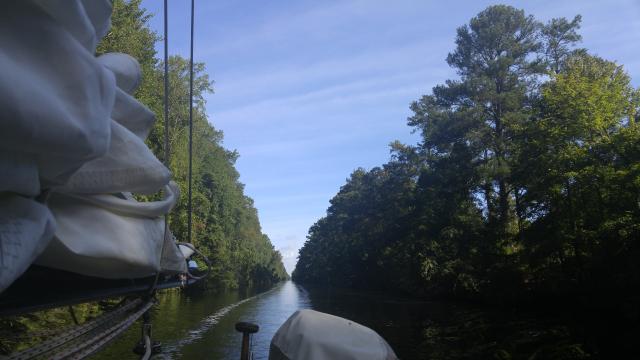
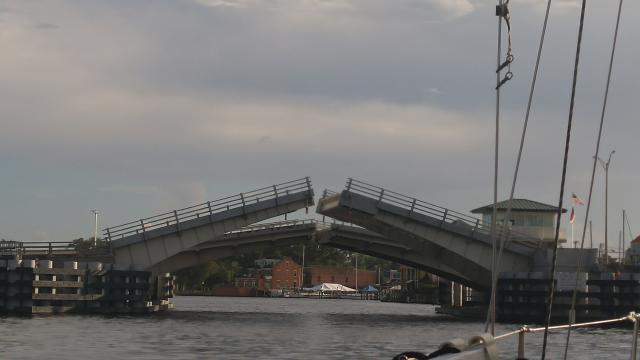
north end of the Dismal Swamp Canal. We lucked out at the Gilmerton
Bridge. It was supposed to be closed much of the weekend for
maintenence but it was open. Problem was NS railroad bridge #7 started
closing just as we arrived. A half hour latter, we could go through the
bridges. Long day with happy endings. Another tropical system moving our way. We estimate that
we have to find our next hidey hole by 19 Sep. Our best shot will be
Elizabeth City at the Pelican. We left HHN 7 days ago with the
intention of moving fast (for us). First night's anchor was on the
bottom of Mill Creek at Solomon's; second night at in Fishing Bay (near
Deltaville), and third night near the entrance of Deep Creek Lock at the
north end of the Dismal Swamp Canal. We lucked out at the Gilmerton
Bridge. It was supposed to be closed much of the weekend for
maintenence but it was open. Problem was NS railroad bridge #7 started
closing just as we arrived. A half hour latter, we could go through the
bridges. Long day with happy endings.
|
|
|
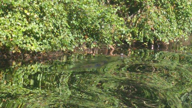
 We transited the DSC without incident
except bumping into
5 deadheads (chunks of tree suspended under the water's surface) along
the way. First time we hit anything but no damage to Jule. We arrived
at the South Mills bridge in time for the 1530 opening which enabled us
to arrive to the Pelican by 1530. Earl and Bryan helped us tie up.
The face dock was rebuilt but it was not very boat friendly with old and
new hardware sticking out of the new pilings. The new owners are trying
to improve their marina but they need to spend time with the details.
We spent 4 days in EC to wait out TS Julia. We transited the DSC without incident
except bumping into
5 deadheads (chunks of tree suspended under the water's surface) along
the way. First time we hit anything but no damage to Jule. We arrived
at the South Mills bridge in time for the 1530 opening which enabled us
to arrive to the Pelican by 1530. Earl and Bryan helped us tie up.
The face dock was rebuilt but it was not very boat friendly with old and
new hardware sticking out of the new pilings. The new owners are trying
to improve their marina but they need to spend time with the details.
We spent 4 days in EC to wait out TS Julia.
|
|
|
 We paid for our luck with many boat project for the next
several days as we waited for TS Julia to come and go. She was swift in
coming and long on leaving. Wind was not as bad as the rain. Ten
inches dumped on EC during the Julia period and other areas got lots
more. We discovered that our macerator pump was bad, one of the digital
GPS antennas failed, and our venerable GPS 75 (over 20 years old)
finally told us it was tired. We used this as our anchor alarm. So we
got a new macerator from Defender, we had a spare digital antenna, and
we retired the GPS 75 in favor of an anchor App on a spare Android
device. While we were at it, we changed fluids and filters as the time
was right. We had lunch with with Billy, filled up our Jerry jugs, and
readied Jule for her last leg to her winter port in Southport. We paid for our luck with many boat project for the next
several days as we waited for TS Julia to come and go. She was swift in
coming and long on leaving. Wind was not as bad as the rain. Ten
inches dumped on EC during the Julia period and other areas got lots
more. We discovered that our macerator pump was bad, one of the digital
GPS antennas failed, and our venerable GPS 75 (over 20 years old)
finally told us it was tired. We used this as our anchor alarm. So we
got a new macerator from Defender, we had a spare digital antenna, and
we retired the GPS 75 in favor of an anchor App on a spare Android
device. While we were at it, we changed fluids and filters as the time
was right. We had lunch with with Billy, filled up our Jerry jugs, and
readied Jule for her last leg to her winter port in Southport.
|
|
25 Sep 2016, Side trip to New Bern, 35 06.048 N/ 077 02.352 W
|
|
|
|
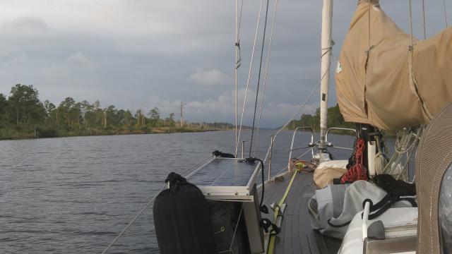 Jule left EC for New Bern 3 days ago on a warm day
with fair breezes to propel her to our first night's anchorage at Deep
Point at the base of the Alligator River. We had two boats to keep us
company. Anchor was set at 1614. We had a calm night and not too warm. Jule left EC for New Bern 3 days ago on a warm day
with fair breezes to propel her to our first night's anchorage at Deep
Point at the base of the Alligator River. We had two boats to keep us
company. Anchor was set at 1614. We had a calm night and not too warm.
|
|
|
 The next day was much like the last. However, Julia had
stirred up the waterway and their was a heap of debris in the Pungo
Canal. Good Samaritans ahead of us called out their sightings of logs
and other debris. We arrived at R.E. Mayo (Hobucken) at 1515 but it was
Sunday and R.E. Mayo was closed. We needed our shrimp and scallops, so
we waited until they opened on Monday, bought our stuff, said goodbye to
the staff, Ann washed her hair, and headed for New Bern. The next day was much like the last. However, Julia had
stirred up the waterway and their was a heap of debris in the Pungo
Canal. Good Samaritans ahead of us called out their sightings of logs
and other debris. We arrived at R.E. Mayo (Hobucken) at 1515 but it was
Sunday and R.E. Mayo was closed. We needed our shrimp and scallops, so
we waited until they opened on Monday, bought our stuff, said goodbye to
the staff, Ann washed her hair, and headed for New Bern.
|
|
|
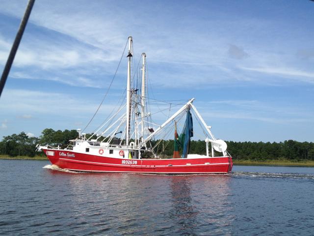
 The trip down Bay River and up the Neuse to New
Bern. Weather was warm with light winds and their way few boats except
a line of shrimp boats that hampered navigation near the dog leg of the
Neuse. They seemed oblivious of any other traffic. A lot of zigging
and zagging and we were free of them. First time for everything. Jule
arrived at the Bridgepointe Marina at 1515 and tied up on the T-head of
A dock. Next day was our social day: Bob and Sally of Endaxi for
breakfast; Dick and Judy of St. Jude for lunch; and Jaren and Nancy of
Nancy D for dinner. We could not think of a better way to (almost)
finish our 2016 voyage. Tomorrow, we head to Southport via Beaufort and
Wrightsville Beach. The trip down Bay River and up the Neuse to New
Bern. Weather was warm with light winds and their way few boats except
a line of shrimp boats that hampered navigation near the dog leg of the
Neuse. They seemed oblivious of any other traffic. A lot of zigging
and zagging and we were free of them. First time for everything. Jule
arrived at the Bridgepointe Marina at 1515 and tied up on the T-head of
A dock. Next day was our social day: Bob and Sally of Endaxi for
breakfast; Dick and Judy of St. Jude for lunch; and Jaren and Nancy of
Nancy D for dinner. We could not think of a better way to (almost)
finish our 2016 voyage. Tomorrow, we head to Southport via Beaufort and
Wrightsville Beach.
|
|
 ;
;


